UN
4 Swallowfields
£ 265,000
Description
We don't have a Description for this property.
- Bedrooms
- 3
- Bathrooms
- 0

Leaflet © OpenStreetMap contributors
The heatmap indicates the level of crime in the area. The color of the heatmap indicates the crime severity and recency.
Metrics Year-on-Year
- Average area value
- 275,043.00 £Decreased by 5.93 %
- Average area rental value
- 1,007.00 £/moIncreased by 20.31 %
- Est rental Yield
- 4.39 %Increased by 27.62 %
- Crime Rate
- 15.00 %Unchanged by 0.00 %
from 292,391.00 £
from 837.00 £/mo
from 3.44 %
from 15.00 %
Nearby Schools
| Name | Type | Ofsted | Distance |
|---|---|---|---|
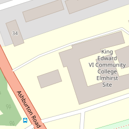
| King Edward Vi Community College | Foundation School | Good | 0.24 KM |
| Totnes Progressive School | Other Independent School | 0.28 KM | |
| The Grove School | Community School | Outstanding | 1.08 KM |
| On Track Education - Totnes | Other Independent Special School | Good | 1.46 KM |
| Park School | Other Independent School | 1.79 KM |
Images
Nearby Streets
| Name | Average Price | Average Sqft | Distance |
|---|---|---|---|
| Swallowfields | £ 415,000 | 0 | 0.00 KM |
| Dartington Lane | £ 350,000 | 0 | 0.00 KM |
| Priory Gardens | £ 0 | 0 | 0.00 KM |
| North Street Mews | £ 325,000 | 0 | 0.00 KM |
| Sawpit Lane | £ 811,667 | 0 | 0.00 KM |
Nearby Transport
| Name | NLC | TLC | Distance |
|---|---|---|---|
| Totnes | 3558 | TOT | 0.60 KM |
Nearby Listings
| Address | Price | Type | Score | Distance |
|---|---|---|---|---|
| Swallowfields, Totnes, Devon, TQ9 | £ 450,000 | BUY | 7 / 10 | 0.01 KM |
| Swallowfields, Totnes, Devon | £ 415,000 | BUY | 5 / 10 | 0.08 KM |
| Swallowfields, Totnes | £ 25,000 | BUY | 5 / 10 | 0.11 KM |
| Weirfields, Totnes | £ 395,000 | BUY | 6 / 10 | 0.40 KM |
| Nellies Wood View, Dartington, Totnes, TQ9 | £ 550,000 | BUY | 6 / 10 | 0.42 KM |
Nearby Properties
| Address | Price | Distance |
|---|---|---|
| 4 Swallowfields | £ 265,000 | 0.00 KM |
| 26 Swallowfields | £ 295,000 | 0.00 KM |
| 11 Swallowfields | £ 285,000 | 0.00 KM |
| 18 Swallowfields | £ 228,500 | 0.00 KM |
| 48 Swallowfields | £ 235,000 | 0.06 KM |